

Sector Público y Social
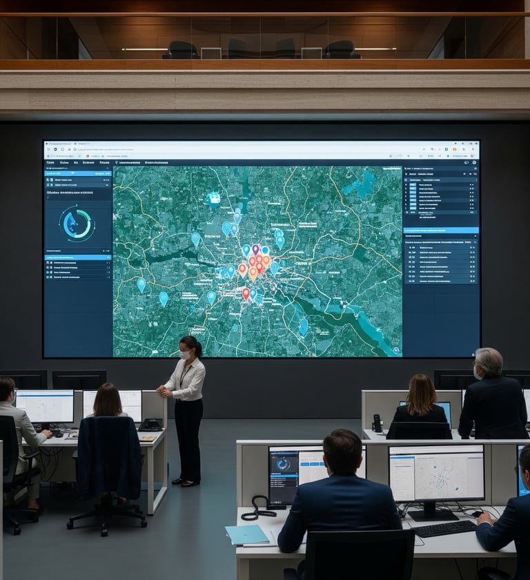
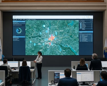
Dichos sectores se perfilan como clientes potenciales a través de los servicios ofertados de Diagnósticos Situacionales, Análisis Geodelictivos y Análisis Geodemográficos. Este segmento incluye a gobiernos, agencias de seguridad y organizaciones no gubernamentales que enfrentan la dificultad de asignar recursos de manera eficiente, la ineficacia en la focalización de programas sociales y la necesidad de justificar sus decisiones con datos fiables y transparentes.
EXCIAT GEO resuelve estos problemas al proporcionar la inteligencia necesaria para focalizar operativos, segmentar territorialmente las necesidades sociales e impulsar decisiones públicas más justas y eficaces.
Clientes Potenciales
Sector Privado y Comercial
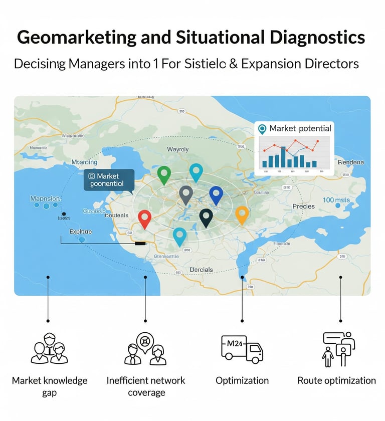
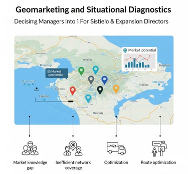
El servicio de Geomarketing resulta de gran relevancia para el sector privado. Los tomadores de decisiones en este sector, como gerentes de marketing y directores de expansión, buscan una ventaja competitiva. Sus principales desafíos son la falta de conocimiento sobre el mercado potencial, la ineficiencia en la expansión de su red de cobertura y la dificultad para optimizar rutas y el posicionamiento de su marca en un determinado territorio.
EXCIAT GEO ofrece una solución a estos problemas al convertir datos geográficos en ventaja competitiva y permitirles tomar decisiones con confianza y precisión.
Sector Académico y Profesional
Este sector se interesa por los servicios de "Investigación Científica" y "Capacitación Diversa". Dicho grupo, compuesto por investigadores, estudiantes de posgrado y profesionales en desarrollo, se enfrenta a la necesidad de mantener un "rigor metodológico" para la "producción técnico-académica", así como a la carencia de habilidades en herramientas analíticas avanzadas, como el SIG.
EXCIAT GEO se posiciona como un "aliado estratégico para potenciar su crecimiento personal y profesional", ofreciendo acompañamiento en el desarrollo de tesis y artículos y fortaleciendo las capacidades técnicas de los equipos con un "enfoque práctico y aplicado".